Observe the scene
Multi-view satellite images, camera models, SAM mask coverage, and inventory metadata.
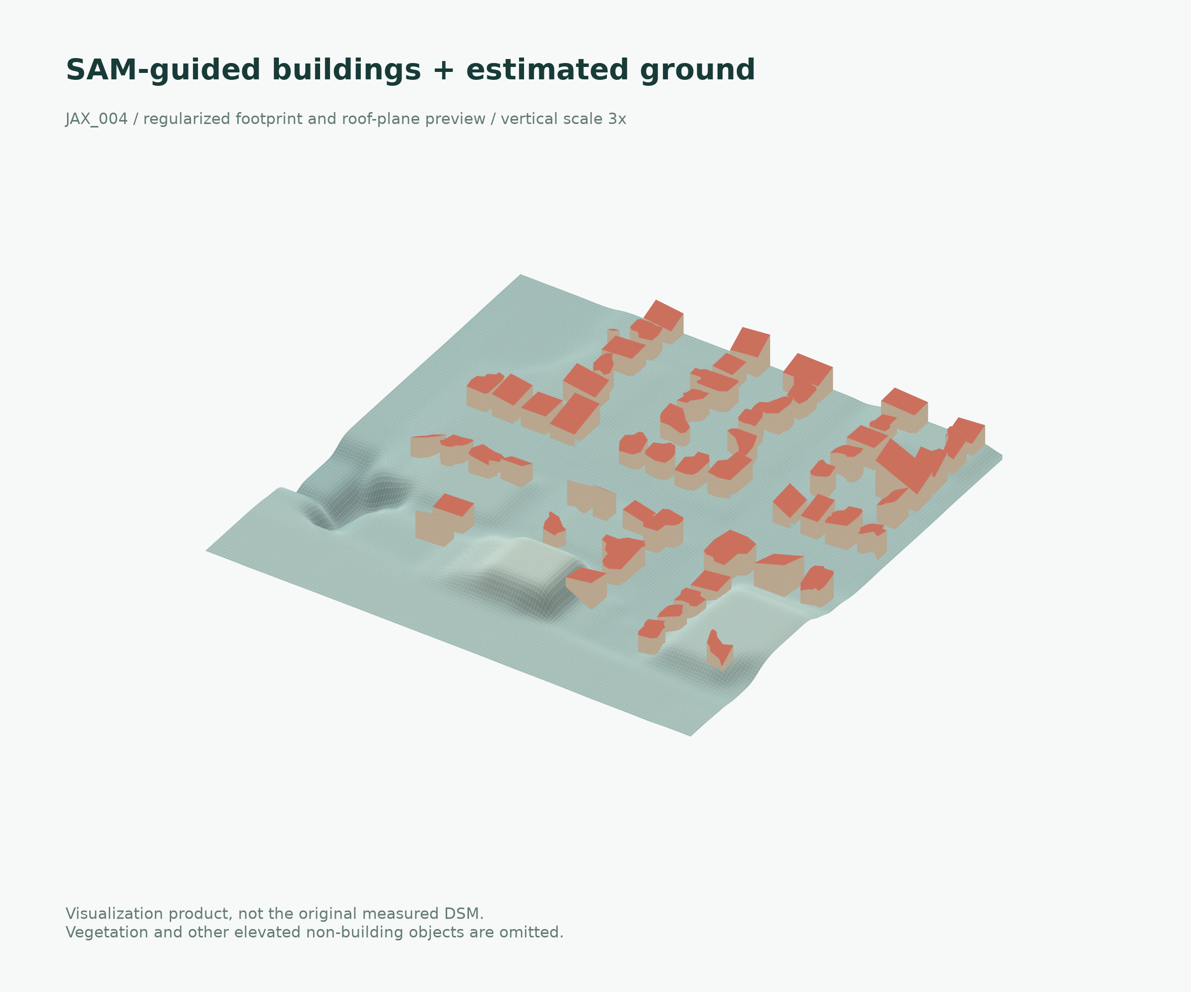
Satellite imagery. Urban geometry.
Building-aware
satellite reconstruction.
Semantic priors guide the reconstruction.
Scene-level evidence guides the decision.
JAX_004 / JACKSONVILLE, FL
Static 3.0 / buildings + ground · 3× vertical scale
Buildings + estimated ground / display layer
RECONSTRUCTION ACCURACY / BEFORE GEOMETRIC POSTPROCESSING
BUILDING-FOCUSED / JAX_004
0.844 → 0.806m
Building MAE · Static weight 2.0
GENERAL DSM / JAX_004
1.362 → 1.349m
Full-scene MAE · Staged schedule
SCENE-SPECIFIC DECISIONS
4evaluated AOIs
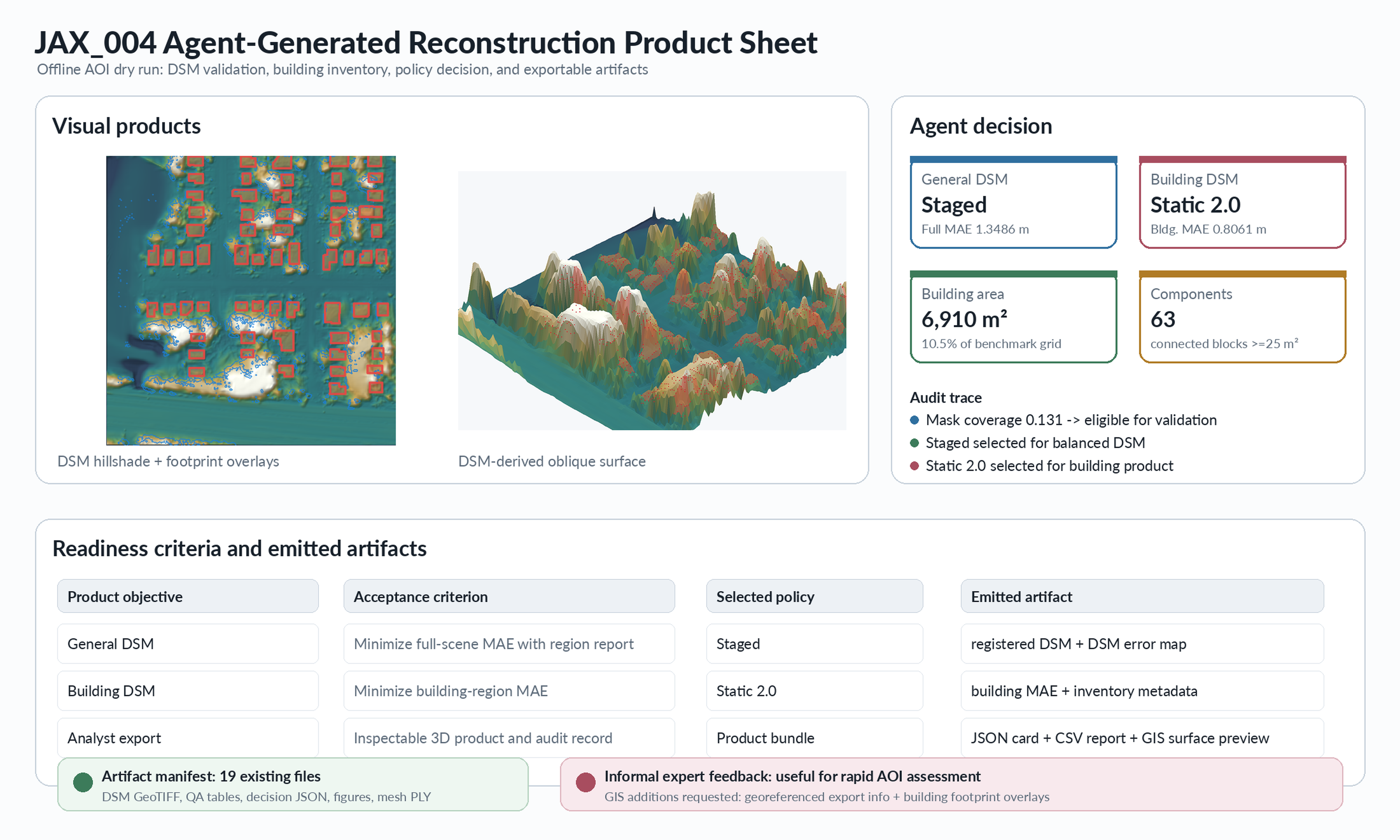
Recorded policies, regional metrics, audit trails
01 / RECONSTRUCTION
One urban scene, two product objectives.
Recorded reconstruction results.
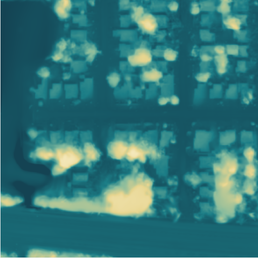
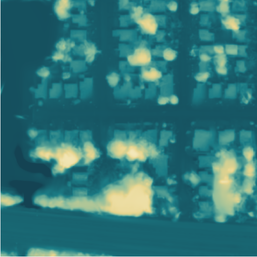 Baseline EOGSStatic 2.050 m
Registered DSMs on the same grid; shared elevation color limits.
02 / SEMANTIC PRIOR + POLICY CONTROL
Building masks express what matters.
Validation determines which policy to keep.
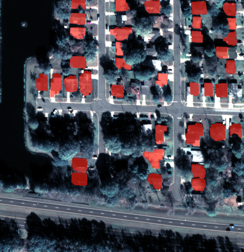
Multi-view satellite images, camera models, SAM mask coverage, and inventory metadata.
Building-weighted Gaussian Splatting with baseline, static, and staged candidate schedules.
w(p) = 1 + (λb − 1) Mb(p)
Compare full-scene, building, vegetation, and non-building MAE. Retain the validated policy for the requested product.
Registered DSM, regional metrics, inventory, and decision records. Optional SAM-guided postprocessing produces regularized roofs and an estimated-ground display layer.
03 / RECORDED AGENT DECISIONS
Semantic weighting helps JAX_004.
The other three AOIs retain their validated baseline.
| Scene | SAM coverage | Building area | Components | Selected policy | Full MAE (m) |
|---|
Offline selection from completed candidate-validation metrics, not a learned policy evaluated on unseen scenes. Building area and component counts come from the benchmark CLS=6 layer (components ≥25 m²), not cadastral records or SAM predictions.
| Policy | Full scene | Buildings | Vegetation | Non-building |
|---|
04 / SAM-GUIDED POSTPROCESSING
A visual edition of Static 2.0.
SAM-guided roofs, sharper building edges.
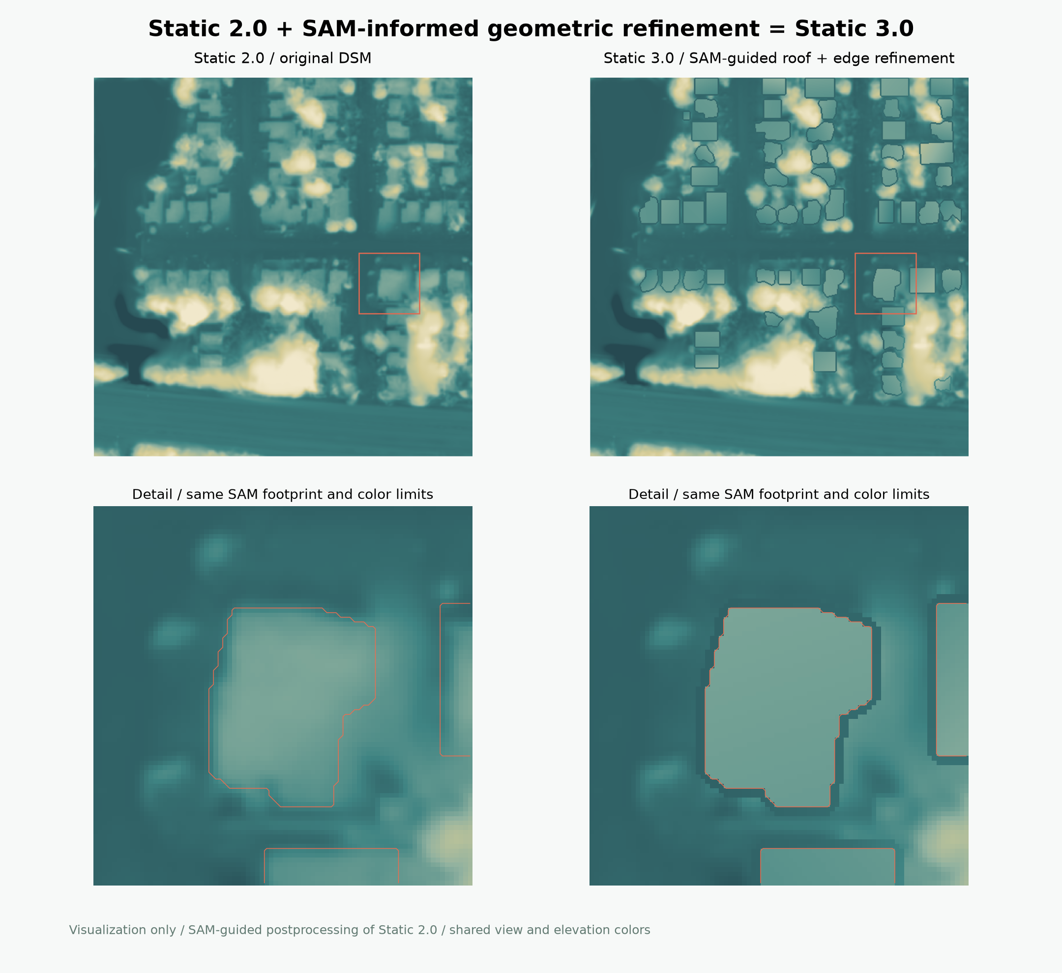
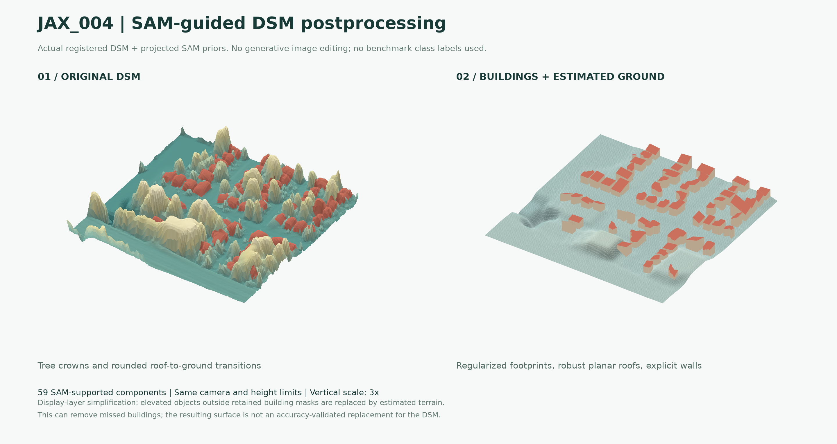
Multi-view mask fusion, contour simplification, and rectangular fitting where supported.
Robust planar fits retain building height structure and make boundaries explicit.
Morphological terrain estimation replaces vegetation and other non-building relief.
Static 3.0 is a visualization-only postprocessing of Static 2.0, separate from the reconstruction results above. The buildings + ground view omits non-building relief, including vegetation and any buildings missed by the masks.
05 / THE RESEARCH
1 University of Waterloo2 University of Calgary3 Sun Yat-sen University
AgentDSM combines SAM-derived building priors with a reconstruction controller around Earth-observation Gaussian Splatting. It makes the building-versus-global accuracy trade-off explicit, selects scene-specific operating points using validation evidence, and exports DSM products with inspectable decision records.
@unpublished{sun_agentdsm_2026,
  title = {Agentic Building-Aware Satellite Gaussian Splatting
           for Auditable Urban DSM Reconstruction},
  author = {Sun, Wentao and Xu, Zhengsen and Chen, Yiping
            and Zelek, John S. and Li, Jonathan},
  year = {2026},
  note = {Research manuscript},
  url = {https://w27sun.github.io/agentdsm/}
}